As part of the Ireland chapter of OpenStreetMap a few years ago I set up a tileserver and a map frontend that defaulted to showing place names in the Irish language (Gaeilge).
Recently I spent some time improving both these services.
Vector Tileserver
Previously the default style was named ‘ga’ and available at: https://tileserver.openstreetmap.ie/styles/ga
However, last weekend I added a new ‘style’ named ‘sraid-v1’. You can take a look at it here:https://tileserver.openstreetmap.ie/styles/sraid-v1/
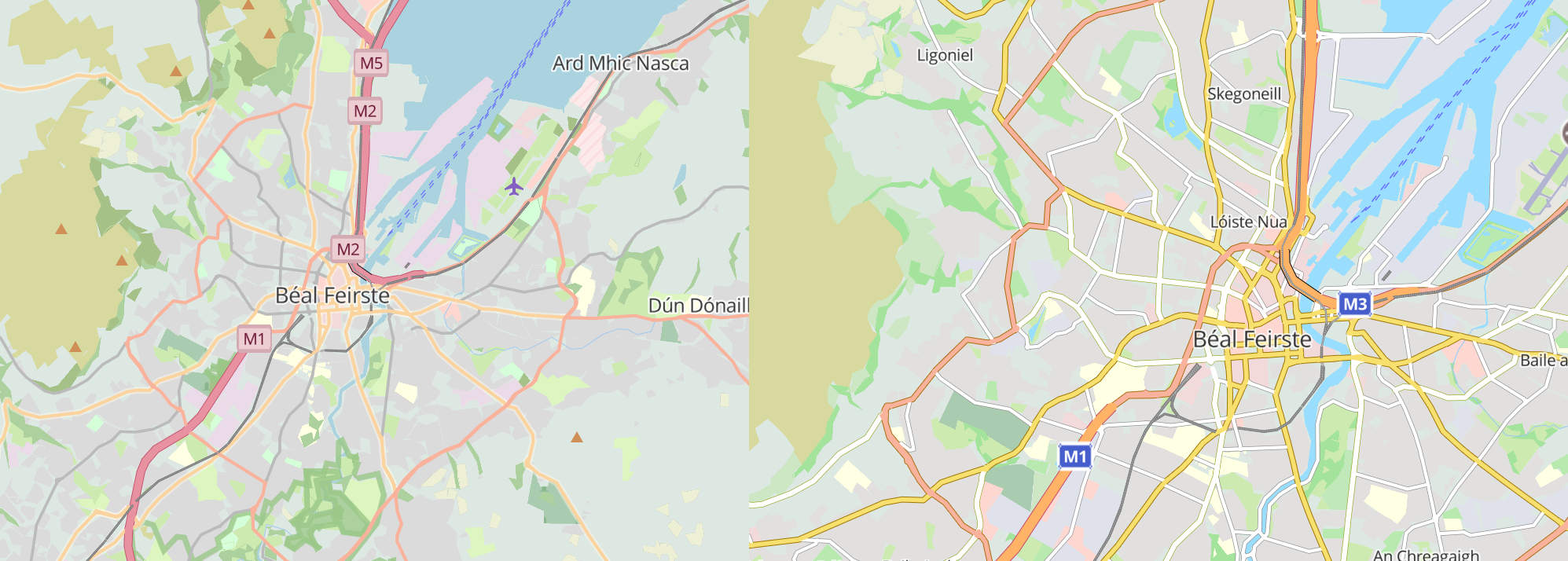
The screenshots below show a comparison. The new style is much brighter and has icons generated from Maki icons into a sprite sheet (see generate_sprites.py in the github repo).
I also fixed a few things I didn’t like about the old ‘ga’ style.
A side-by-side is shown below:
If you want to use it in your own maps you will need to change the code where it currently points to:https://tileserver.openstreetmap.ie/styles/ga/
You can now use:https://tileserver.openstreetmap.ie/styles/sraid-v1/
So to use this vector tileset you might use something like the code below with MapLibreGL
var map = new maplibregl.Map({
  container: 'map',
  style: 'https://tileserver.openstreetmap.ie/styles/sraid-v1/style.json' + keyParam,
  hash: true,
  maxPitch: 85
});
The previous style ‘ga’ is still present so there should be no breaks in functionality if you choose to continue using the old style.
The code is available here: https://github.com/jonnymccullagh/irish-language-osm-tiles
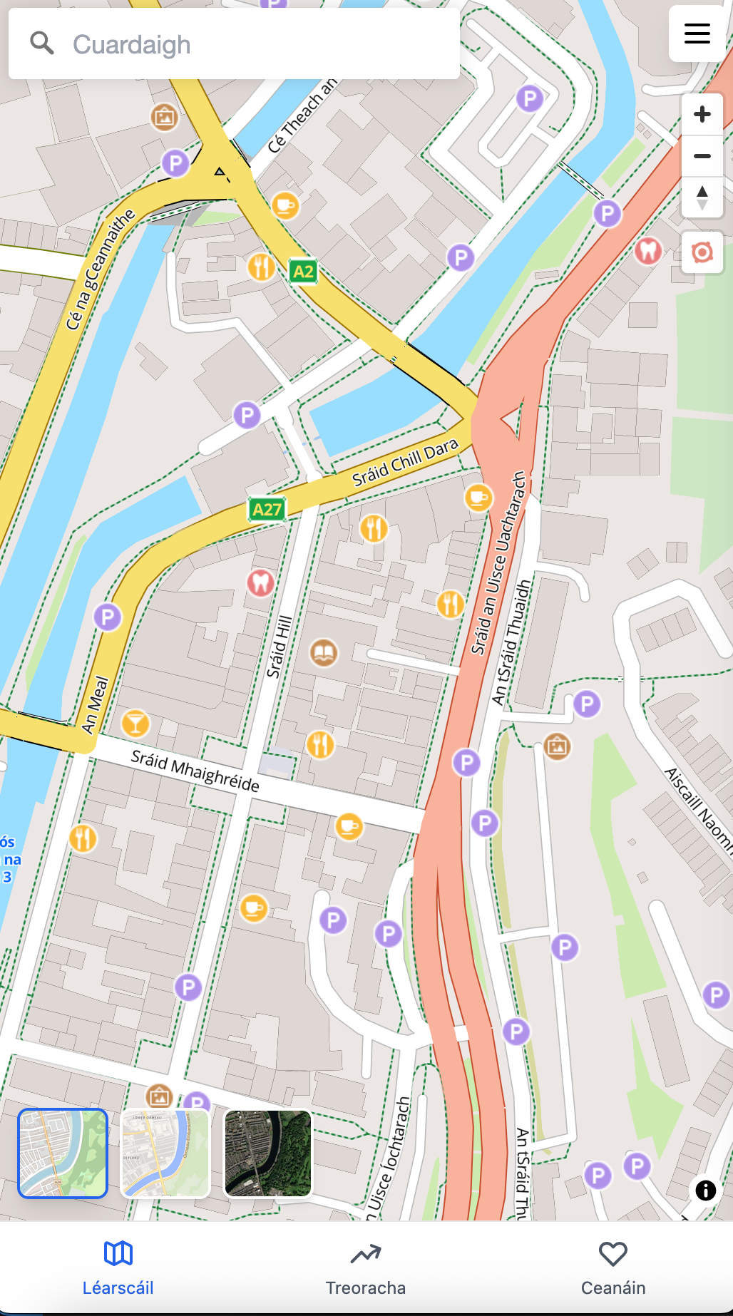
Léarscáil
I did a big upgrade for the service that displays the map from the tileserver:
https://learscail.openstreetmap.ie
This latest version uses React frontend with a node backend. The backend only proxies to the the external APIs that require an API key that I would not want to share publicly (Logainm, Graphhopper, geograph).
The frontend does not require a login and there is no tracking. Any preferences saved are stored locally in the user’s browser (local storage).
The code also contains a tauri wrapper that will allow builds of the app for Android, iOS, Linux, Mac or Windows but I will have to make a few amendments for the services that require an API key.
New Features:
- New Style: It uses the new style mentioned above (sraid-v1).
- Location Info: When clicking on place names you get an info panel which includes info from Logainm, Wikipedia and a photo from geograph.ie – if data exists.
- Directions: There is also a feature to get directions between two places (uses Graphhopper at the moment but I may add support for https://project-osrm.org/)
- Home: you can right-click to save a ‘home’ location
- History: Stores the list of recently clicked locations
- Favourites:
- Right-click to create a favorite
- Right-click to show/hide favorites
- Export favorites to a .mappa file to send to others
- Import favorites from a .mappa geojson file
The code is available here: https://github.com/jonnymccullagh/learscail